
फायल:Map Norway political-geo.png

मुळावी फायल (1,920 × 2,902 चित्रतत्व, फायलीचो आकार: 924 KB, माइम प्रकार: image/png)
सारांश
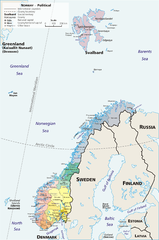
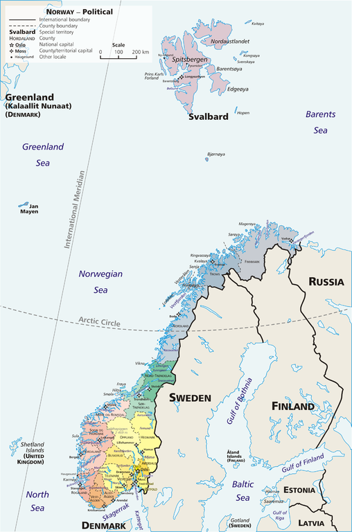
Map: Norway – geopolitical
Exhibits counties (fylker) of Norway (19); colours correspond to regions of Norway:
- yellow: Østlandet (Austlandet)
- orange: Sørlandet
- red: Vestlandet
- green: Trøndelag
- blue: Nord-Norge
Also:
Drawn by E Pluribus Anthony, adapted from:
- Statistics Norway: This is Norway Yearbook, p. 44 (PDF)
- National Geographic Xpeditions Atlas (Map Machine): Norway (PDF)
- Image:Bjornoya map.png

|
This map image could be re-created using vector graphics as an SVG file. This has several advantages; see Commons:Media for cleanup for more information. If an SVG form of this image is available, please upload it and afterwards replace this template with
{{vector version available|new image name}}.
It is recommended to name the SVG file “Map Norway political-geo.svg”—then the template Vector version available (or Vva) does not need the new image name parameter. |
परवांगी
| This work has been released into the public domain by its author, E Pluribus Anthony. This applies worldwide. In some countries this may not be legally possible; if so: |
Link: http://en.wikipedia.org/wiki/Image:Map_Norway_political-geo.png
derivative works
Derivative works of this file: Jan Mayen ringed.png
फायलीचो इतिहास
त्या वेळार फायल कशी आशिल्ली तें पळोवपाक त्या तारीख/वेळाचेर क्लिक करात
| दिस / वेळ | ल्हान-इमाज़ | परिमाण | वापरपी | शेरो | |
|---|---|---|---|---|---|
| आताचें | 12:06, 30 जुलय 2010 | | 1,920 × 2,902 (924 KB) | Hayden120 | Restored map proportions to original. |
| 11:56, 30 जुलय 2010 |  | 1,920 × 2,902 (1.04 MB) | Hayden120 | Corrected spelling of Trøndelag. | |
| 19:55, 1 मे 2006 |  | 1,920 × 2,902 (969 KB) | Mortadelo2005 | == Summary == Map: Norway – geopolitical Exhibits counties (''fylker'') of Norway (19); colours correspond to regions of Norway: * yellow: Østlandet (Austlandet) * orange: Sørlandet * red: Vestlandet * g |
फायलिचो वापर
हें पान ही फायल वापरता:
भुमंडळ फाइलीचो वापर
सकयल दिल्ल्यो विकी ही फायल वापरतात
- af.wikipedia.org चेर जाल्ले वापर
- ang.wikipedia.org चेर जाल्ले वापर
- ar.wikipedia.org चेर जाल्ले वापर
- ast.wikipedia.org चेर जाल्ले वापर
- awa.wikipedia.org चेर जाल्ले वापर
- azb.wikipedia.org चेर जाल्ले वापर
- az.wikipedia.org चेर जाल्ले वापर
- ban.wikipedia.org चेर जाल्ले वापर
- be.wikipedia.org चेर जाल्ले वापर
- bpy.wikipedia.org चेर जाल्ले वापर
- bug.wikipedia.org चेर जाल्ले वापर
- ca.wikipedia.org चेर जाल्ले वापर
- crh.wikipedia.org चेर जाल्ले वापर
- cy.wikipedia.org चेर जाल्ले वापर
- da.wikipedia.org चेर जाल्ले वापर
- de.wikipedia.org चेर जाल्ले वापर
- diq.wikipedia.org चेर जाल्ले वापर
- dsb.wikipedia.org चेर जाल्ले वापर
- dty.wikipedia.org चेर जाल्ले वापर
- el.wikipedia.org चेर जाल्ले वापर
- en.wikipedia.org चेर जाल्ले वापर
- es.wikipedia.org चेर जाल्ले वापर
- es.wikibooks.org चेर जाल्ले वापर
- fa.wikipedia.org चेर जाल्ले वापर
- fj.wikipedia.org चेर जाल्ले वापर
- fo.wikipedia.org चेर जाल्ले वापर
- fr.wikipedia.org चेर जाल्ले वापर
ह्या फायलीचें वैश्वीक वापरांची चड म्हायती पळयात.