फायल:The Blue Marble (remastered).jpg
पानाचो मजकूर हेर भासानी समर्थीत ना.
विकिपीडिया कडल्यान

मुळावी फायल(3,000 × 3,000 चित्रतत्व, फायलीचो आकार: 5.69 MB, माइम प्रकार: image/jpeg)

ही फयल Wikimedia Commons हांगाची आनी ती हे प्रकल्पां खातीर वापरल्यार चलता. (तिच्या https://commons.wikimedia.org/wiki/File:The_Blue_Marble_(remastered).jpg ह्या फयलींतलें वर्णनाचे पान) तातूंतलें वर्णन सकयल दिलां.


सारांश

The Blue Marble  wikidata:Q202014 reasonator:Q202014
Photographer
NASA/Apollo 17 crew; taken by either Harrison Schmitt or Ron Evans
image of artwork listed in title parameter on this page
Title
The Blue Marble
Part of Apollo 17 Edit this at Wikidata
Object type photograph Edit this at Wikidata
Genre astrophotography Edit this at Wikidata
वर्णन
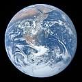
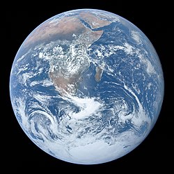
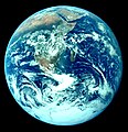
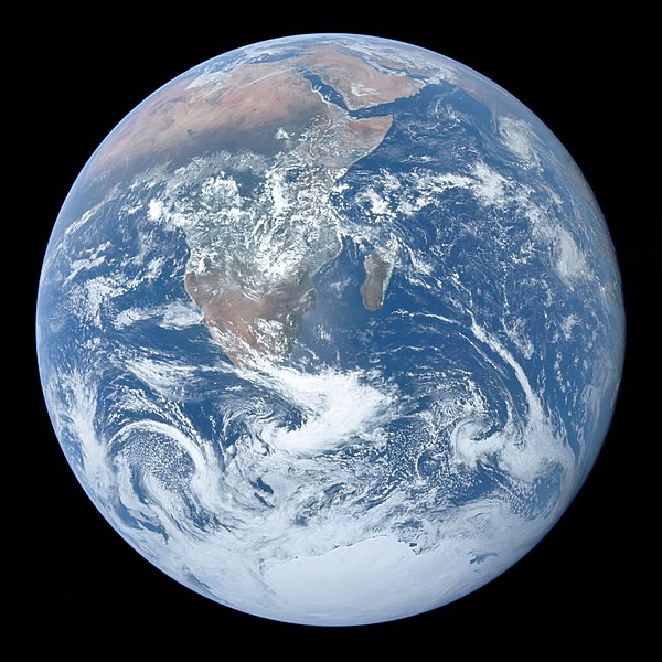
Full disk view of the Earth taken on December 7, 1972, by the crew of the Apollo 17 spacecraft en route to the Moon at a distance of about 29,400 kilometres (18,300 mi). It shows Africa, Antarctica, and the Arabian Peninsula.
तारीख 7 डिसेंबर 1972
date QS:P571,+1972-12-07T00:00:00Z/11
Medium 1 photograph: Hasselblad 500EL, Zeiss Planar 80 mm f/2.8 and 70mm Kodak Ektachrome film of type SO-368
This image or video was catalogued by Johnson Space Center of the United States National Aeronautics and Space Administration (NASA) under Photo ID: AS17-148-22727.

This tag does not indicate the copyright status of the attached work. A normal copyright tag is still required. See Commons:Licensing.
Other languages:
Notes The end of most film magazines used on the Apollo missions include a photograph, presumably taken on earth, of a "KODAK Color Control Patch" on a chart containing mission and camera data. This color chart was used to calibrate the above photograph to better approximate real-world colors.
Earth disk center rough coordinates: 26°19’49”S 37°25’13”E
References https://tothemoon.ser.asu.edu/gallery/Apollo/17/Hasselblad%20500EL%2070%20mm
स्रोत http://tothemoon.ser.asu.edu/gallery/Apollo/17/Hasselblad%20500EL%2070%20mm https://www.flickr.com/photos/projectapolloarchive/21081863984/
Other versions

[बदल]

Other versions:

Derivative works:

Object location26° 19′ 49″ S, 37° 25′ 13″ E Kartographer map based on OpenStreetMap.View this and other nearby images on: OpenStreetMapinfo

परवांगी

Public domain This file is in the public domain in the United States because it was solely created by NASA. NASA copyright policy states that "NASA material is not protected by copyright unless noted". (See Template:PD-USGov, NASA copyright policy page or JPL Image Use Policy.)
Warnings:

Captions

Add a one-line explanation of what this file represents
A full disk of the Earth, centered on the sea off Mozambique, as taken by the crew of Apollo 17 on 7 December 1972, from 29,400 km (18,300 mi) above. Africa, Southwest Asia and Antarctica are shown.

Items portrayed in this file

depicts इंग्लीश

The Blue Marble इंग्लीश

based on इंग्लीश: AS17-148-22727 इंग्लीश
inception इंग्लीश: 7 डिसेंबर 1972

Apollo 17 इंग्लीश

digital representation of इंग्लीश

The Blue Marble इंग्लीश

creator इंग्लीश

copyright status इंग्लीश

no known copyright restrictions इंग्लीश

determination method इंग्लीश: work of the federal government of the United States इंग्लीश

public domain इंग्लीश

media type इंग्लीश

image/jpeg

width इंग्लीश

3,000 pixel

height इंग्लीश

3,000 pixel

aspect ratio (W:H) इंग्लीश

1:1 इंग्लीश

color इंग्लीश

color इंग्लीश

inception इंग्लीश

7 डिसेंबर 1972

data size इंग्लीश

5,969,721 byte

checksum इंग्लीश

6ffb103228140aac1c7977b004b7d93a

determination method इंग्लीश: MD5 इंग्लीश

964dc6dc213994404a37486cc306a12a690804ab

determination method इंग्लीश: SHA-1 इंग्लीश

e156f6b91e809d853ebf95e50546cf9767119b2f7ae66057514d1c9b

determination method इंग्लीश: SHA-224 इंग्लीश

e42f2650cd861c9f79c8ac6342adf465a11385a5f2d92b9db8b23962e85b06bc

determination method इंग्लीश: SHA-256 इंग्लीश

286f6c0809d0f86e425e0e827b9dddfa47f3a90285cf747b790dd87d8bddcd27068e896cdfddb3eafd40f94c07758ef8

determination method इंग्लीश: SHA-384 इंग्लीश

ea79d861354ed3d6845d470a165073b5679f1b05b2d7e14fc7bf900185d0132955db7d48456fc4c5a3c03447460c4f448f25ab39c2ff28f1b8a8eeb02c7b9e2c

determination method इंग्लीश: SHA-512 इंग्लीश

coordinates of geographic center इंग्लीश

26°S, 37°E

coordinates of depicted place इंग्लीश

26°19'49.001"S, 37°25'13.001"E

फायलीचो इतिहास

त्या वेळार फायल कशी आशिल्ली तें पळोवपाक त्या तारीख/वेळाचेर क्लिक करात

दिस / वेळल्हान-इमाज़परिमाणवापरपीशेरो
आताचें19:42, 26 फेब्रुवारी 2022 19:42, 26 फेब्रुवारी 2022मेरेनचे आवृत्ती खातीर ल्हान-इमाज़3,000 × 3,000 (5.69 MB)CactiStaccingCranecropped by 2 pixels to get a perfect 3000 by 3000
06:29, 16 फेब्रुवारी 2022 06:29, 16 फेब्रुवारी 2022मेरेनचे आवृत्ती खातीर ल्हान-इमाज़3,000 × 3,002 (5.3 MB)Aaron1a12Added slight tilt as published by NASA
04:52, 16 फेब्रुवारी 2022 04:52, 16 फेब्रुवारी 2022मेरेनचे आवृत्ती खातीर ल्हान-इमाज़3,000 × 3,002 (4.91 MB)Aaron1a12EV lowered
03:06, 5 फेब्रुवारी 2022 03:06, 5 फेब्रुवारी 2022मेरेनचे आवृत्ती खातीर ल्हान-इमाज़3,000 × 3,002 (5.23 MB)Aaron1a12Uploaded a work by The Crew of Apollo 17 from NASA/JSC/ASU with UploadWizard

हें पान ही फायल वापरता:

भुमंडळ फाइलीचो वापर

सकयल दिल्ल्यो विकी ही फायल वापरतात

ह्या फायलीचें वैश्वीक वापरांची चड म्हायती पळयात.

मेटाडॅटा

"https://gom.wikipedia.org/wiki/फायल:The_Blue_Marble_(remastered).jpg" चे कडल्यान परतून मेळयलें